Magdalenian Maps
From YPPedia
| Magdalenian Maps | |
|---|---|
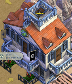
| Left-facing Explorers' Hall on Arakoua Island (Ibis Archipelago) Sage Ocean | |
| Proprietorship | |
| Owner | Gwen |
| Manager(s) | Cremate, Shroomy |
| Erected | November 2009 |
| Dusted | Date unknown |

| |
Magdalenian Maps was an explorers' hall on Arakoua Island on the Sage Ocean.
Magdalenian Maps most likely refers to the Magdalenian, an Upper Paleolithic culture that resided in the area of modern-day France.
![]() Arr! This article about a building in Puzzle Pirates be a stub. Ye can help YPPedia by expanding it.
Arr! This article about a building in Puzzle Pirates be a stub. Ye can help YPPedia by expanding it.